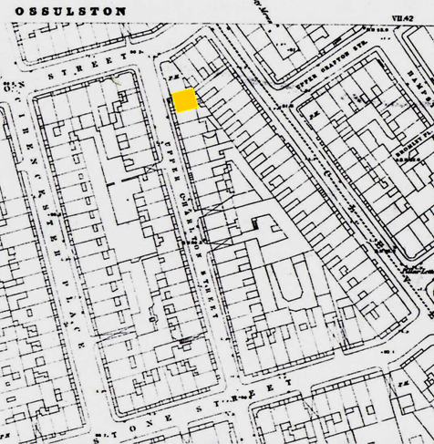
4. Upper Charlton Street in a detail of the Ordnance Survey map, 1872 (I have marked no. 17 with a yellow rectangle).
Image courtesy of the City of Westminster Archives Centre.